NASA Satellite Images Show Wildfire Damage to Santa Rosa Island
NASA satellite imagery reveals burn scars from a wildfire that consumed roughly one-third of Santa Rosa Island in Channel Islands National Park.
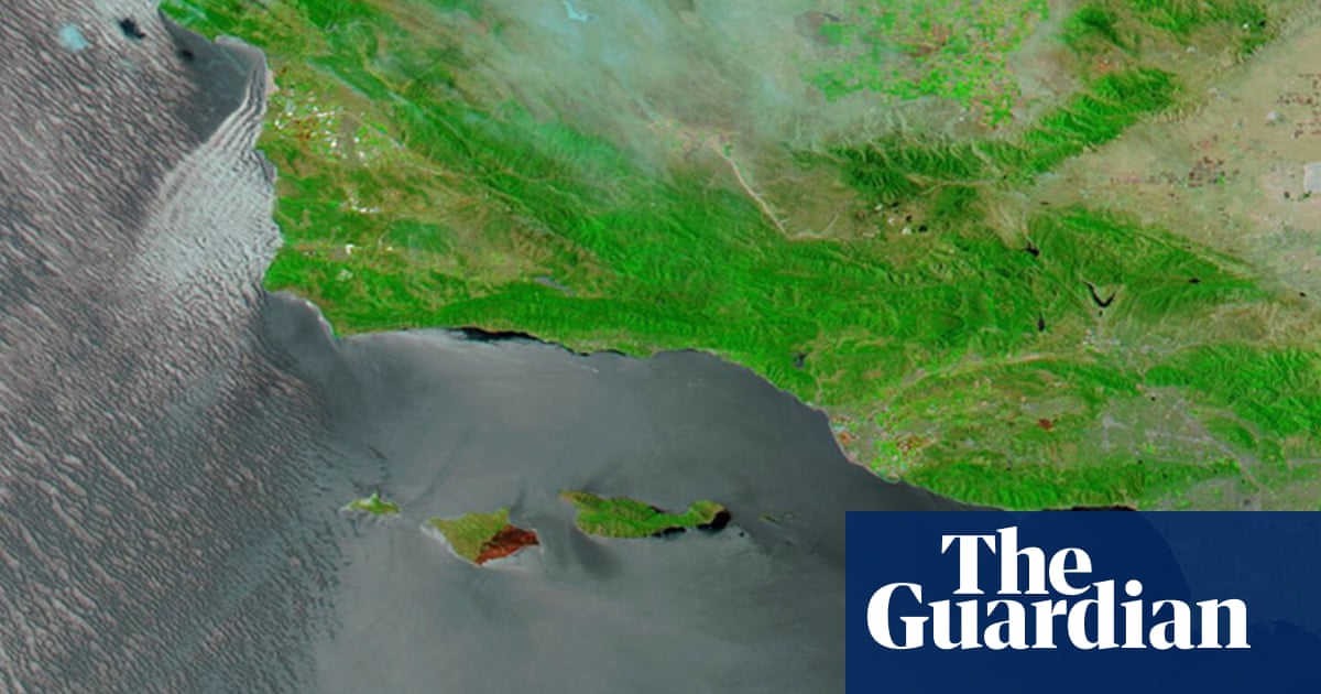
NASA satellite imagery has captured the extent of damage from a wildfire that burned approximately one-third of Santa Rosa Island, part of California's Channel Islands National Park located off the southern coast.
The satellite images, taken on May 20 by NASA's Moderate Resolution Imaging Spectroradiometer (MODIS), show false-color imagery revealing extensive burn scars across the island. The visuals display large swaths of blackened land where the fire swept through the island's terrain.
Santa Rosa Island is one of five islands that comprise Channel Islands National Park. The island is known for its unique ecosystems and has been referred to by some as the "Galapagos of California" due to its rare plant and animal species.
The wildfire tore through various rare ecosystems on the island, leaving behind visible damage that can be clearly seen in the satellite imagery. The burn area appears as darkened patches against the surrounding landscape in the NASA photographs.
Channel Islands National Park encompasses five islands off the California coast and is home to numerous endemic species. The park's islands are considered significant for conservation due to their isolated ecosystems and unique biodiversity.